DataVis.ca
Michael Friendly
York University

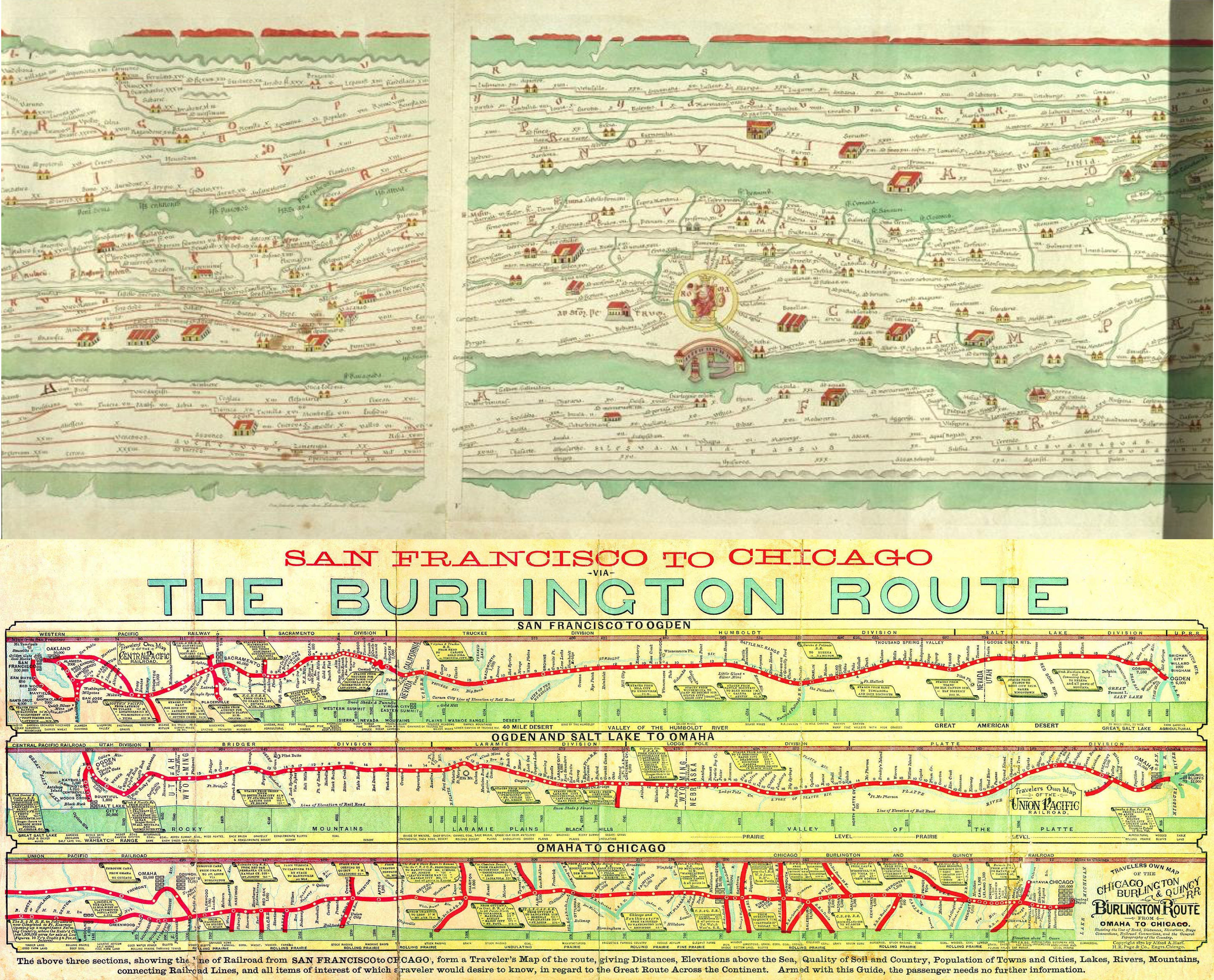
Title: (a) Peutinger Table (b) Chicago to San Franciso via the Burlington Route
Author: (a) Konrad Peutinger (b) Alfred A. Hart
Location: (a) Augsburg, Germany (b) Chicago, IL, U.S.A
Year: (a) 1508 (b) 1870
The primary function of maps has always been wayfinding (how do I get from A to B?), but standard maps don’t serve that function as well as route maps that show one path of travel, but do so with much greater detail than a standard map affords: what will you see, where to stay, etc. on a given trip.
(a) This Roman road map dating from the fourth century AD is called after Konrad Peutinger (1465-1547) of Augsburg. He came into possession of the map in 1508. The original map was made during the reign of Emperor Augustus (63 BC – 14 AD). As the first known road map, it showed the whole of the Roman world, as a travel map from Vienna, through Italy, to Carthage (34 cm. high, by 7 m. long). The icons show towns, churches, spas, etc.
(b) The second example shows an 1870 depiction of the passage from San Francisco to Chicago by train along the Burlington Route, giving “all items of interest of which a traveler would desire to know.” It's a stylized, diagramatic strip map in three sections: Chicago to Omaha; Omaha; Omaha to Salt Lake and Ogden (via the Union Pacific); Ogden to San Francisco (via the Central Pacific).
Image Source: (a) Hartley & Woodward, History of Cartography; (b) author’s image collection.
 Except where otherwise noted, the Gallery of Data Visualization by
Michael Friendly is licensed under a
Except where otherwise noted, the Gallery of Data Visualization by
Michael Friendly is licensed under a Creative Commons Attribution-NonCommercial 3.0 License. Please cite any uses of this work as shown below.
Citation: Friendly, Michael (2001), Gallery of Data Visualization, Electronic document, http://www.datavis.ca/gallery/,