DataVis.ca
Michael Friendly
York University

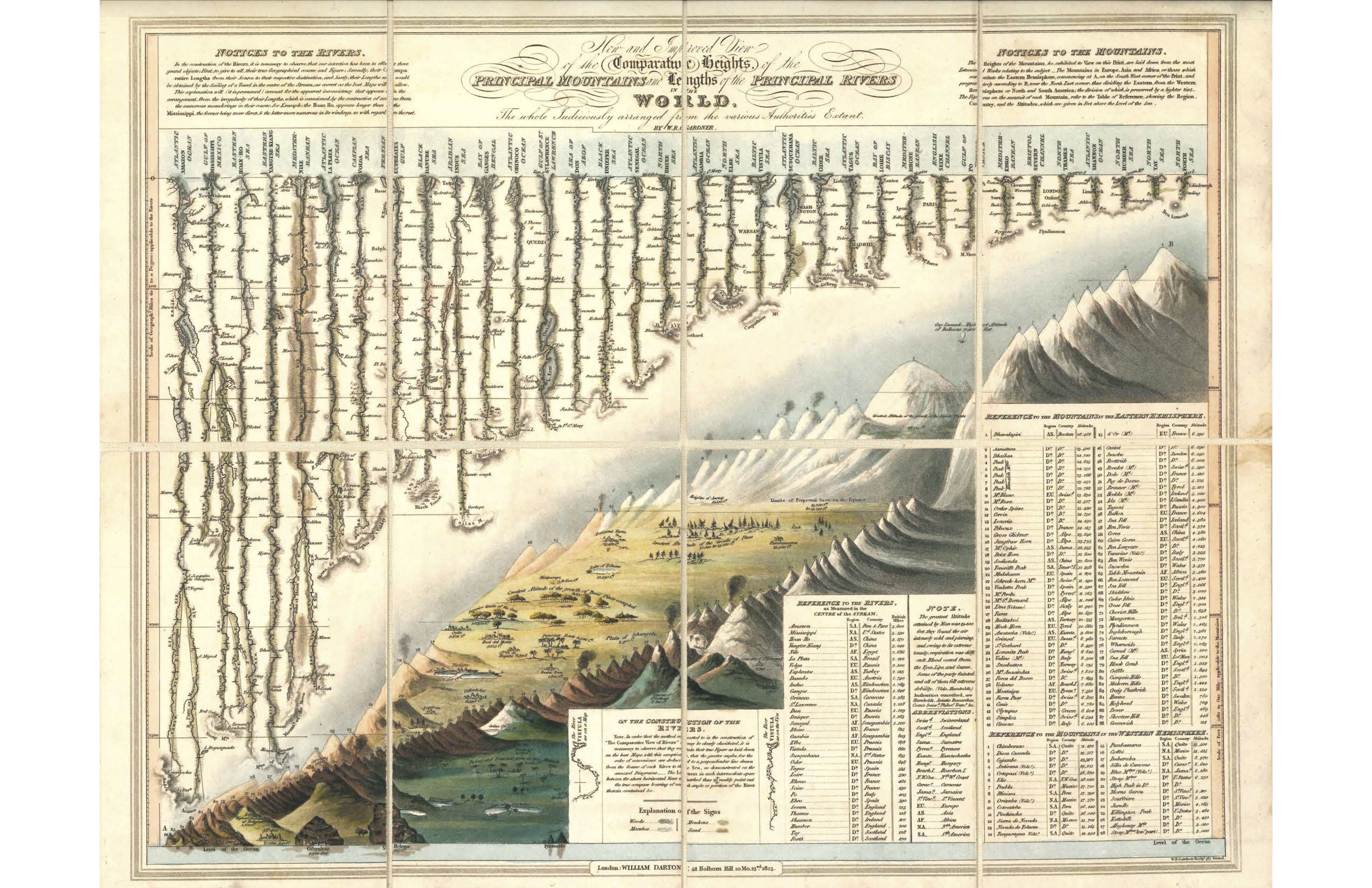
Title: New and Improved View of the Comparative Heights of the Principal Mountains and Lengths of the Principal Rivers in the World
Author: W. R. Gardner & William Darton
Location: London, England
Year: 1823
How can one show the heights of the highest mountains and lengths of the longest rivers in the world in a single, comprehensive view?
This 1832 image by W. R. Gardner & William Darton set a new theme for depicting the world in a totally new way, both dramatic and detailed. It launched decades of similar comparative charts of geographical features without the constraints of the map.
They order the rivers by length and the mountains by height in a pleasing display; but they also show details of the rivers and mountains both in numerical tables and in a whimsical design depicting features to excite the imagination.
This particular copy was prepared as a “case map”: fixed to a linen backing in a 2 x 4 format that folded into a cardboard sleeve. It was a gift to me from Raymond Andrews, http://infowetrust.com
 Except where otherwise noted, the Gallery of Data Visualization by
Michael Friendly is licensed under a
Except where otherwise noted, the Gallery of Data Visualization by
Michael Friendly is licensed under a Creative Commons Attribution-NonCommercial 3.0 License. Please cite any uses of this work as shown below.
Citation: Friendly, Michael (2001), Gallery of Data Visualization, Electronic document, http://www.datavis.ca/gallery/,